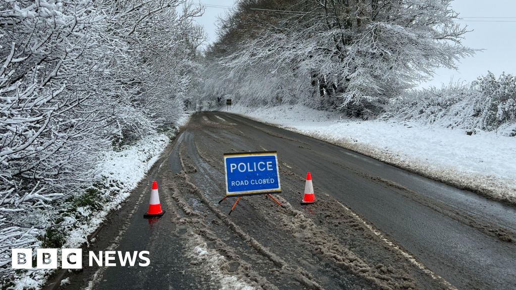
Temperatures have dropped as colder arctic air spreads across the UK, with amber cold weather health alerts in place ahead of a weekend of snow for much of the country.
Met Office yellow warnings for snow and ice have been issued for much of England and Wales and parts of Scotland over the course of three days this weekend, with cold conditions forecast to continue into Monday.
Separate warnings for ice are in force on Thursday and Friday after much of the UK was lashed by strong winds and heavy rain, which led to widespread flooding across the north-west of England.
A number of flood warnings and alerts stay in place in north-west England as a major clean-up operation continues after hundreds were evacuated from their homes.
Colder conditions bring to an end a run of unseasonably mild weather over the festive period, which saw highs of between 11C and 13C forecast on Christmas Day.
Temperatures are set to be around 5C below the early January average, with a wind chill making it feel even colder.
Amber cold health alerts cover the whole of England but are not in place for the rest of the UK.
The UK Health Security Agency (UKHSA) issues the alerts when adverse temperatures are likely to impact on people’s wellbeing, in particular those who are elderly or have health conditions. The alerts provide early warning to healthcare providers.
A yellow warning for ice is in place across north west England, western Scotland and Northern Ireland from 17:00 GMT on Thursday until Friday morning as temperatures drop through the night.
The Met Office also warns of snow in north east Scotland, including the Orkney and Shetland Islands, into Friday.
The larger snow and ice warning starts at noon on Saturday until midnight, and covers all regions of England apart from the South West, and the majority of Wales.
Most of Scotland is covered by a separate snow warning from midnight on Sunday until 12:00 GMT on Monday.
Saturday is likely to be the coldest day as most areas will see top temperatures of around -1C to 2C. There will be overnight frosts in the coming nights too.
While we are now in a cold snap with wintry showers and potential for significant snow over the weekend for some, this is nothing unusual for winter in the UK.
As a weather system approaches the UK late on Saturday, rain will bump into the colder Arctic air and turn to snow.
Snow will temporarily fall in parts of southern England before quickly turning back to rain on Saturday night with milder air moving in.
For Wales, the Midlands and northern England there could be as much as 5cm of snow falling to low levels and for a time, freezing rain which brings icy conditions.
As much as 20-30cm of accumulating snow is possible over higher ground in parts of Wales and the Pennines. Strengthening wind blizzards and drifting snow could lead to depths of snow up to 40cm over these areas too.
There is potential for travel disruption, power cuts and some rural communities being cut off.
By Sunday and overnight into Monday, the focus of heavy snow will transfer to Scotland with an additional Met Office yellow warning in force suggesting 2-3cm of snow at low levels and as much as 20cm over higher ground.
This weather set up, where you have cold air sitting across the UK with a rain-bearing weather system from the Atlantic moving through, is a tricky one for forecasters.
How much snow and the exact locations where it will fall can be difficult to pin down more than a day ahead, leading to uncertainties in the forecast.
The Department for Work and Pensions (DWP) said on Thursday that no fresh postcodes had been triggered for cold weather payments.
Payments of £25 are made to eligible households when an area’s average temperature has been recorded as, or is forecast to be, 0C or below for seven consecutive days.
The fresh Met Office warnings come after many Britons had their new year’s celebrations accompanied by heavy rain and extensive flooding, including in Greater Manchester where a major incident was declared on New Year’s Day.
Places affected include Bolton, Didsbury, South Manchester, Harpurhey, north Manchester, Stalybridge, Stockport and Wigan.
Twenty flood warnings remain in place in the north west and evacuation centres have opened in Wigan, Stockport and in Ormskirk, Lancashire, to support those who had to leave their homes.
In Cheshire, the banks of the Bridgewater Canal collapsed with water pouring into surrounding fields at Little Bollington, prompting road closures and property evacuations.
About 3.5in (90mm) of rain has fallen widely across north-west England over the last 24 hours with more than 3.9in recorded on some hills in north Wales and Cumbria.
