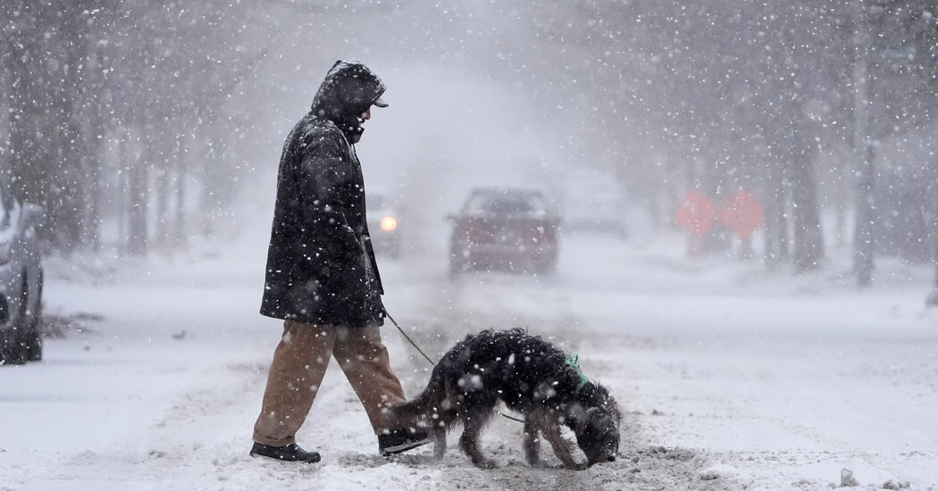
A winter storm unfurled a blanket of snow and ice along the East Coast on Monday, disrupting routines in much of the Mid-Atlantic and the Northeast.
In the coming days, a rush of Arctic air was expected to deepen the chill.
Nighttime temperatures were expected to fall into the single digits across the Central Plains and into the Mississippi and Ohio Valleys this week, The Weather Prediction Center warned. The Mid-Atlantic region was expected to be not quite as chilly, with daytime temperatures near freezing.
“It will mainly just be cold for much of the Central and Eastern U.S. for the week,” Zack Taylor, a meteorologist at the National Weather Service, said.
He added that another winter storm was expected to hit Texas in about two days. State officials there activated an emergency response on Monday evening.
The snowfall on Monday seriously snarled travel into and out of Washington, D.C., where up to a foot was expected to accumulate overnight despite an afternoon lull. The Ronald Reagan Washington National Airport shut down its runways Monday evening in order to clear the snow, and said it might not reopen until morning.
The storm also closed public schools in the city on Monday, and they would remain closed on Tuesday, officials said.
Across the United States, more than 9,000 flights — including the majority of those scheduled at Reagan — were delayed or canceled as of Monday evening, according to FlightAware, a flight tracking service.
Amtrak canceled dozens of trains in the busy Northeast Corridor and other affected states, and driving conditions were dangerous from West Virginia to Delaware.
More than 200,000 people in the storm’s path, from Missouri to Virginia, were without power late Monday afternoon, according to the utility tracking website PowerOutage.us, though the number appeared to be shrinking.
In Richmond, Va., power outages affected the water reservoirs, prompting city officials to issue a boil water advisory and to warn that some residents would temporarily lose their water service.
Some Southern states got a mix of sleet, freezing rain and icy buildup on Monday, as well as thunderstorms. In northern Kentucky and parts of southern West Virginia, ice accumulation was forecast to surpass a quarter-inch, which could create dangerous conditions for drivers and pedestrians and could increase the risk of power failures.
Deadly snow blasted Central states.
The storm has been moving east from the Central United States, where blizzard conditions in Kansas and Missouri led to the deaths of at least three people and created hazardous conditions for travelers.
The National Weather Service in Kansas City, Mo., reported that the international airport there had received 11 inches of snow on Sunday, the fourth-largest single-day total in the city’s recorded history.
In Topeka, Kan., the Weather Service said late Sunday that it expected a final total of 14.1 inches, which would be the third-highest single-day snowfall recorded in the area.
People in the Kansas City area hunkered indoors, hemmed in by ice-covered driveways and roads deemed too treacherous for travel. In some places, lightning and booming thunder accompanied gusting winds as the storm blew across the region.
“This is a rare blizzard for Kansas City,” Gary Lezak, a longtime meteorologist in the area, said on Sunday. “It is insanely cold.”
It was deadly, too. In Kansas, west of Salina, a fire truck and several tractor-trailers and passenger vehicles overturned; an S.U.V. slid off the road near Wichita and rolled down an embankment, killing both occupants.
Cold weather lingers.
The snow was expected to taper off by Tuesday morning, although light snowfall may continue during the day over parts of the Central Appalachians, with the cold, gusty weather to follow. Mr. Taylor of the National Weather Service said that cold weather advisories had been issued extending as far south as Florida.
From the eastern Rockies to the East Coast, temperatures were forecast to be about 10 to 12 degrees below seasonal averages.
And in Texas, where another storm threatened to reignite longstanding concerns about the resilience of the state’s power grid, Gov. Greg Abbott on Monday activated emergency response resources to prepare for the frigid weather.
“We’re watching that next storm system move into Texas by midweek — Wednesday to Thursday,” Mr. Taylor said. “And there we could see a pretty impactful winter storm affecting Dallas and perhaps San Antonio and Austin.”
Christine Chung, Campbell Robertson, Ali Watkins and Yan Zhuang contributed reporting.
